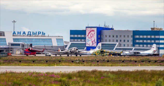
Anadyr (Ugolny) Airport is a mixed-use military and civil airport in the Russian Far East located 11 km east of Anadyr, separated from the town by the waters of Anadyrsky Liman. It became the primary hub for civilian flights in the Chukotka region.
The main purpose of building on the airfield - the possibility of refueling the war, replenishing nuclear energy (nuclear initiatives) includes the strategic activities of the USSR in the case of the United States. To store nuclear revenues in permafrost (about 10 km from the airfield), a huge underground storage facility "Portal" with anti-nuclear protection was built in the mid-1950s.
In Anadyr CTR boundaries altitudes are calculated in meters by QFE
Transition altitude: 2000 m./ 7000 ft.
Transition level:
FL080 when QFE ≥ 760 mm(1013 hPa)
FL090 when 760 mm(1013 hPa) > QFE ≥ 733 mm(977 hPa)
FL100 when QFE < 733 mm(977 hPa)
Airport apron usage procedures:
ACFT with a wingspan of more than 26 m shall taxi into stands 13-16 under tow, if the relevant adjacent stand (14-17) is occupied /under own engines power, if the relevant adjacent stand (14-17) is vacant
ACFT with a wingspan of more than 15 m shall taxi into stands 10-12 under tow, if the relevant adjacent stand (11-13) is occupied/under own engines power, if the relevant adjacent stand (11-13) is vacant
Index 2 HEL (diameter of the main rotor 16 – 22 m) shall taxi into stand 9 under tow, with flight crew exercising extreme caution.
Stands 1-5, 8-9, 19-22 are available for parking of helicopters.
Helicopter traffic – limitation:
During the day helicopter VFR take-off/landing shall be operated from/on stands 7, 19, 20, TWY F and RWY.
| RWY | MAG BRG | Dimensions(m) | Landing system |
|---|---|---|---|
| 02/20 | 015° | 3500x60 | ILS CAT I (110.300) |
| 195° | ILS CAT I (110.700) |
| Position | Designator | Callsign | Frequency |
|---|---|---|---|
| FSS * | RU-ERC_FSS | Eastern Russia Control | 135.550 |
| Control | UHMM_CTR | Magadan-Control | 134.600 |
| Control * | UHMM_N1_CTR | Magadan-Control | 133.000 |
| Approach | UHMA_APP | Anadyr-Approach | 120.500 |
| Tower * | UHMA_TWR | Anadyr-Start | 124.000 |
| ATIS | UHMA_ATIS | Anadyr-ATIS | 125.400 |
| Title | Type | Tags | Addition time |
|---|---|---|---|
|
Project Oblivion - UHMA Anadyr for X-Plane 11 |
scenery | xPlane 11 | 09.11.2024 |
| (no description) | |||
|
Siberian Scenery Development - UHMA Anadyr v1.0
|
scenery | MSFS 2020 | 20.01.2024 |
| (no description) | |||
|
RU Scenarios - UHMA Anadyr for MSFS |
scenery | MSFS 2020 | 20.01.2024 |
| (no description) | |||
|
UHMA Anadyr for P3D v.4.4+ |
scenery | P3Dv4 P3Dv5 | 23.03.2022 |
| (no description) | |||
|
UHMA Anadyr for FSX |
scenery | FSX | 31.03.2020 |
| (no description) | |||
![]()
2026 © VATRUS division
Русская версия
VATSIM –
Code of Conduct
–
Устав VATRUS
–
Privacy Policy